Superimpose Your Polar Plot in Google Earth

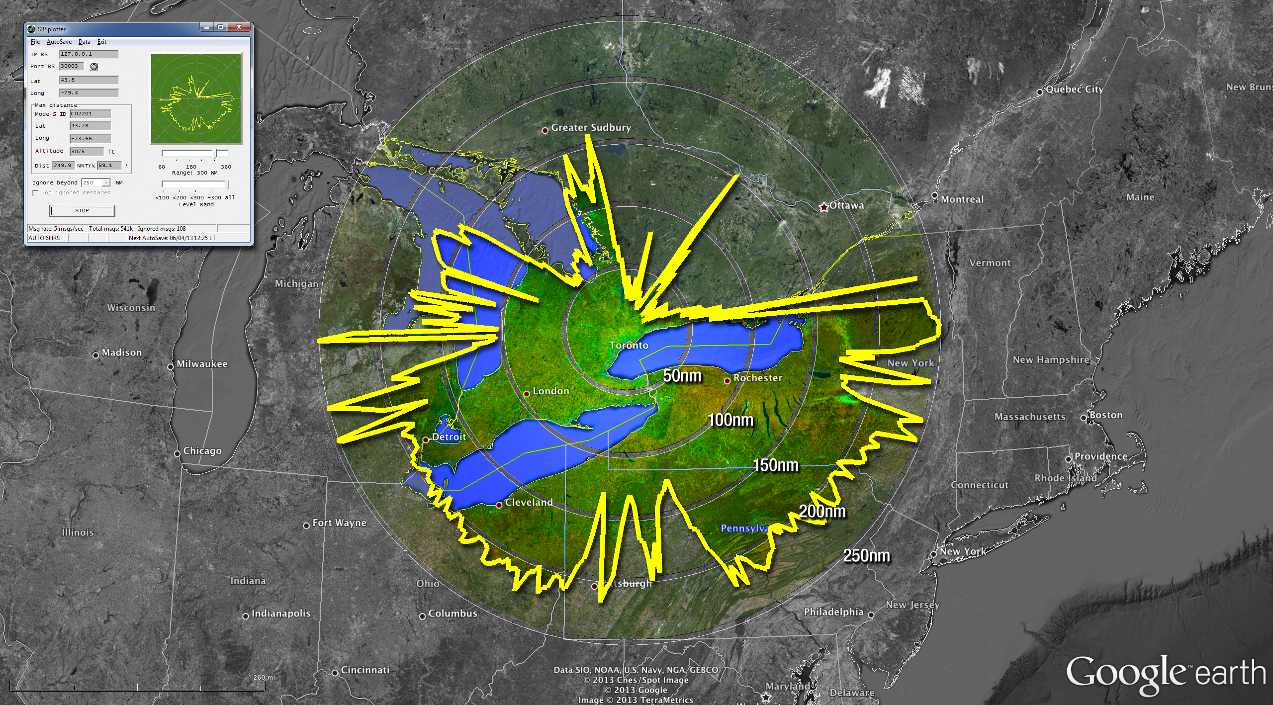
The polar plot above was made using the SBS Plotter software (top-left inset). The data was then massaged into a format that could be imported into Google Earth. The rest is some Photoshop magic. Here’s how I made the image above… Gather Data I use the SBS Plotter software to create the polar plot. This …

Mode-S and ADS-B on a Raspberry Pi

Caveat What follows is what I wrote the day after setting up my Raspberry Pi to receive and decode Mode-S and ADS-B messages from commercial aircraft. Before publishing this post, I followed my own instructions to get it working a second time. I failed. I failed not because my steps are wrong; I failed not …

How to Setup ADSBScope

There has been quite a bit of back and forth on the RTL1090 Yahoo Group lately about setting up ADSBScope to monitor aircraft using an RTLSDR dongle. It isn’t difficult, but ADSBScope isn’t very intuitive and the German spellings in some of the menu items could lead to some confusion. However, since it’s free, you …

BaseStation and RTL1090

If you’ve read my first post, you may have noticed a passing reference to an optional piece of software called BaseStation. This application is the software that ships with the Kinetic Avionics SBS radar boxes. However, you can also download the software and — using some third-party magic — connect it to your cheap RTLSDR dongle. …

Using 2 RTLSDR dongles to expand coverage

If you’re like me, you’ve setup your RTLSDR dongle, you’ve connected some software to it, you’ve seen some aircraft on your screen and you’ve said, “Cool! How do I see more?” If you’re even more like me, you can’t get your antenna up to the roofline so it has a nice 360˚ view of the …