
I see a lot of questions about whether the stock antenna that comes with many of the RTLSDR dongles is any good. The answer is dependent on many variables, including how high you have the antenna placed. Today I did a test and took a dongle, the stock antenna and my laptop to Toronto Pearson …
Tag Archives: virtual radar
Superimpose Your Polar Plot in Google Earth
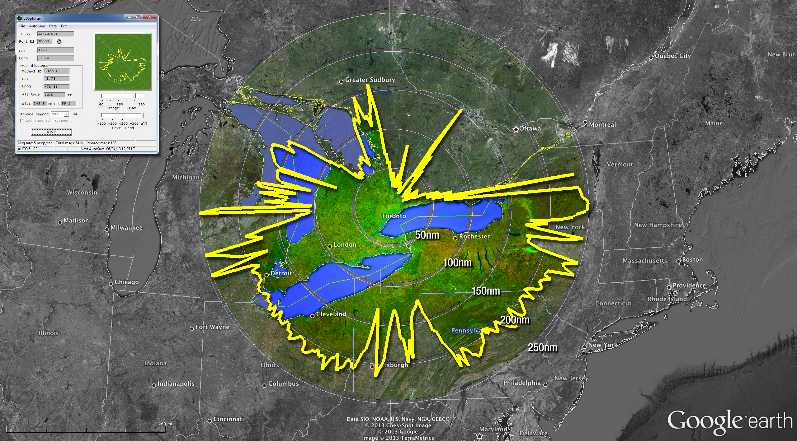
The polar plot above was made using the SBS Plotter software (top-left inset). The data was then massaged into a format that could be imported into Google Earth. The rest is some Photoshop magic. Here’s how I made the image above… Gather Data I use the SBS Plotter software to create the polar plot. This …
Continue reading “Superimpose Your Polar Plot in Google Earth”
Mode-S and ADS-B on a Raspberry Pi
Caveat What follows is what I wrote the day after setting up my Raspberry Pi to receive and decode Mode-S and ADS-B messages from commercial aircraft. Before publishing this post, I followed my own instructions to get it working a second time. I failed. I failed not because my steps are wrong; I failed not …
How to Setup ADSBScope
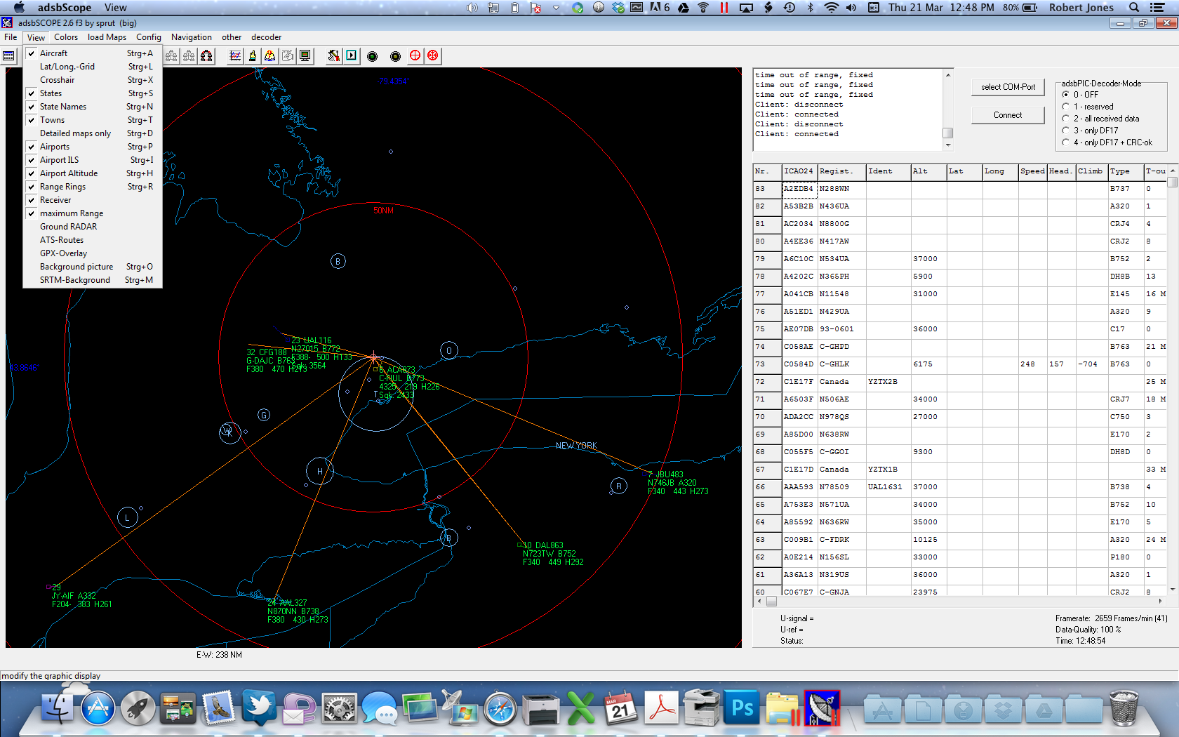
There has been quite a bit of back and forth on the RTL1090 Yahoo Group lately about setting up ADSBScope to monitor aircraft using an RTLSDR dongle. It isn’t difficult, but ADSBScope isn’t very intuitive and the German spellings in some of the menu items could lead to some confusion. However, since it’s free, you …
Today’s Flights — How To Extract Data from BaseStation.sqb
I recently added a page to this website, Today’s Flights, that shows all of the aircraft recorded by my virtual radar setup during the calendar day. If you’re interested in doing the same on your website, here’s a tutorial that explains how I did it with my WordPress-based blog. What You Will Need sqlite3.exe — …
Continue reading “Today’s Flights — How To Extract Data from BaseStation.sqb”